|
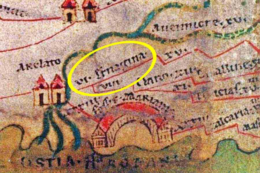
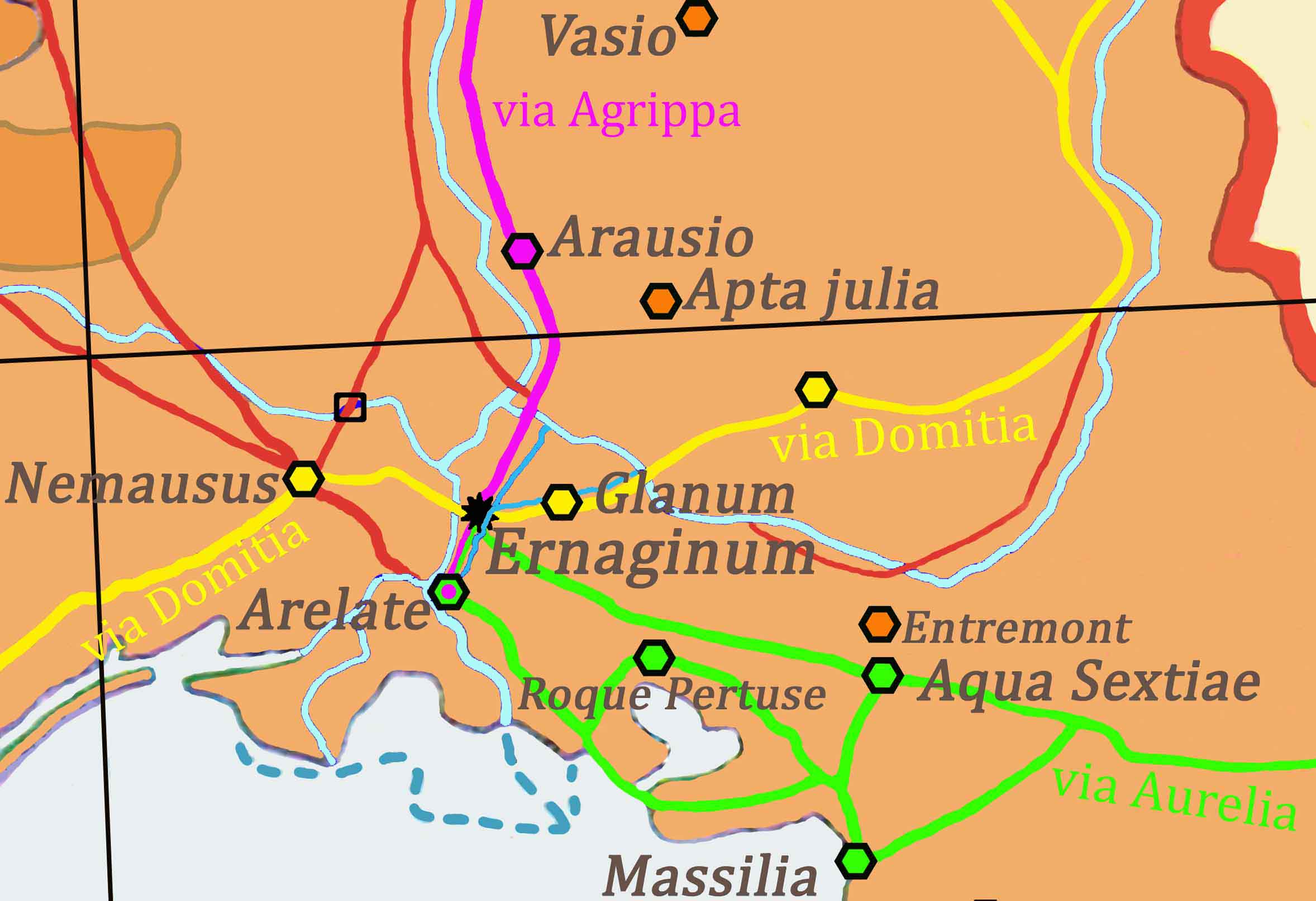
Ernaginum,
Ernagina, Ernagena, Ernagino, Ernagini, Ernagin, Arnaginem, Arnagine,
Bergine, Berginé,
Ερναγινον. What
names for a town now long since disappeared!
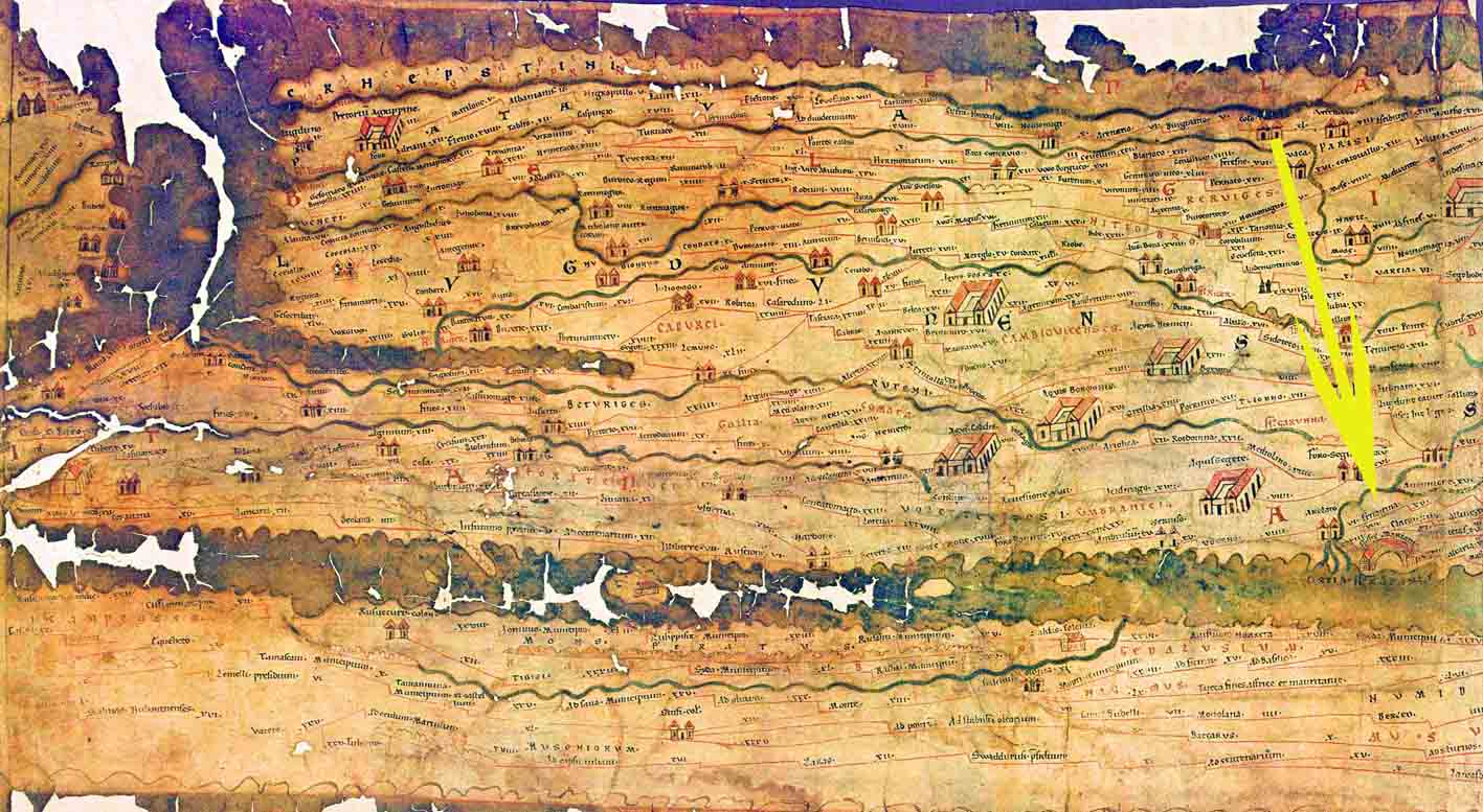
Ernaginum: the
most important crossroads of Roman Gaul. In fact it was
here that the Via Domitia (which continued onto Spain) met the Via
Agrippa
(from Arles and then onto Lyon) and the Via Aurelia (the coast-‐road from Rome).
At the foot of
Ernaginum flowed the two branches of the River Durance,
one from Chateaurenard, via Maillane and Laurade, the other from Orgon
via
Saint-‐Remy. From here the waters
continued towards Arles flowing into the
ponds of Desuviates which then linked into the Marius canal and the
sea, near
Fos.
Ernaginum was
an important city whose economy depended principally on
these three great routes, together with the crossing of both the Rhone
and the
marshes of the Durance which at this point was assured by local
boatmen. The
town extended over 2 km along the edge of the hill.
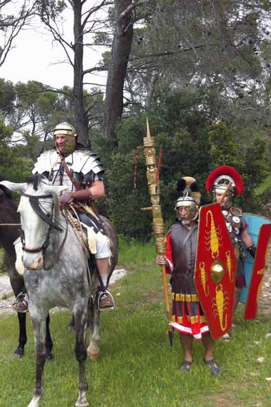
Ernaginum
served as the advance camp for the Emperor Marius to protect
Arles against attacks from the Cimbres in approximately 100 BC. At that
time
called Bergine it was perhaps the capital of a Gallic tribe belonging
to the
federation of Salyens: the Nearchi.
This tribe of
shepherds and farmers, who lived in the Alpilles and on
part of the Crau in the 6th century, was nevertheless trading with
ships from
the Mediterranean (Punic, Etruscan and Greek).
In 480
Ernaginum was destroyed stone by stone by the Visigoths. Rebuilt,
it was again destroyed, this time in the 11th century by the Saracens
from
Spain.
Ernaginum
would have been more important than Glanum and would have
included at least five cemeteries.
|